
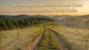
When people imagine the Boone Trace, they often picture a rugged path carved through wilderness by early pioneers. But historians now agree that the trail was not created randomly. Instead, Boone Trace was carefully shaped by the natural landscape, especially rivers and ridges. These features determined where people could travel safely and efficiently across mountains, forests, and valleys.
Long before settlers moved west, Native American tribes followed the same natural paths. Rivers provided water and food, while ridges offered high ground that avoided swamps and floods. When Daniel Boone and other explorers traveled through the region, they followed these natural guides. As a result, Boone Trace became one of the most practical and important routes into the American frontier.
Why Nature Decided the Route
In the eighteenth century, there were no paved roads or detailed maps. Travelers had to rely on the land itself. Rivers, hills, and valleys shaped where people could go. Trying to travel straight across rough land was dangerous and exhausting. Instead, travelers followed routes that nature made easier.
Ridges were especially important because they stayed dry and allowed people to see ahead. Moving along high ground also reduced the risk of getting lost. Rivers, on the other hand, offered water, fish, and clear direction. Even when travelers left a river, they could often use it as a guide.
Boone Trace took advantage of both. It followed ridges when crossing mountains and rivers when moving through valleys. This natural design helped thousands of settlers move west.
The Role of Rivers Along Boone Trace
Rivers were like highways in early America. They guided travelers through unfamiliar land and connected distant places. Along Boone Trace, several important rivers played a key role. These waterways gave people drinking water and a way to transport supplies.
Travelers often walked along riverbanks because the ground was easier to follow. Rivers also helped people find their way back if they got lost. When Boone Trace crossed rivers, it usually did so at shallow or narrow points that had been used for generations.
Settlements later grew near these river crossings. Over time, many towns formed where Boone Trace met water routes, showing how deeply the trail was connected to rivers.
How Ridges Made Travel Safer
Ridges were another major influence on Boone Trace. A ridge is a long, narrow hill that runs between valleys. These high paths stayed dry during rain and avoided thick forests or muddy ground. Walking along ridges was easier than climbing up and down hills all day.
Historians believe that Boone Trace followed ridges for long stretches. This allowed travelers to move faster and stay safer. From a ridge, they could see danger coming and find their way more easily.
These ridge paths were not new. Native American tribes had used them for centuries. Boone and his group simply widened and improved them for horses and wagons.
Daniel Boone’s Use of the Landscape
Daniel Boone was not just a trailblazer. He was also a skilled reader of the land. He understood that nature showed the best way to travel. Boone paid close attention to river valleys, mountain gaps, and ridgelines.
Instead of forcing a straight path, Boone worked with the terrain. He chose routes that followed gentle slopes and avoided dangerous areas. By doing so, he made Boone Trace easier for families, animals, and supplies to move across.
This careful use of the land helped Boone Trace become one of the most trusted routes into Kentucky and beyond.
Why These Natural Paths Were Already Known
Long before settlers arrived, Native American tribes had created a network of paths that followed rivers and ridges. These routes connected villages, hunting grounds, and trade centers. They were shaped by experience and deep knowledge of the land.
When Boone and other explorers came, they learned from this knowledge. They followed existing paths and adjusted them for their needs. This made Boone Trace more efficient and safer than if it had been built from scratch.
Historians now see Boone Trace as a blend of Indigenous travel networks and colonial expansion.
How Boone Trace Shaped Settlement
Because Boone Trace followed rivers and ridges, it became a natural route for settlement. People traveling west wanted safety, water, and clear direction. The trail offered all three.
Farms, towns, and forts began to appear along the trail. These places depended on rivers for trade and ridges for protection. Over time, Boone Trace became more than just a path. It became the backbone of growth in the region.
Many modern roads still follow the same natural lines, proving how powerful these original routes were.
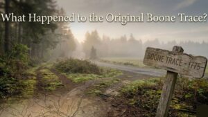
Why This History Matters Today
Understanding how Boone Trace was shaped by rivers and ridges helps us see history more clearly. It shows that early travel was not random but guided by the land. It also reminds us that the trail was built on much older Indigenous routes.
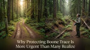
Preserving what remains of Boone Trace means protecting a story that is both natural and human. The land itself holds memory, and every ridge and river crossing tells part of the tale.
Conclusion
Historians agree that Boone Trace was not just a man-made trail. It was shaped by rivers that guided travelers and ridges that kept them safe. These natural features made the trail practical, reliable, and long-lasting.
By following the landscape, Boone and others created a path that opened the American frontier. Today, remembering how Boone Trace followed nature helps us appreciate the deep connection between history and the land we walk on.